Unraveling the Complexity: A Comprehensive Guide to Creating an AutoCAD Civil 3D Surface
AutoCAD Civil 3D, a robust civil engineering design software developed by Autodesk, is renowned for its advanced capabilities in creating precise and detailed surface models. These surfaces serve as the foundation for various civil engineering projects, including road design, land development, and hydraulic modeling. In this extensive guide, we explore the intricacies of creating surfaces in AutoCAD Civil 3D, covering fundamental concepts, workflow strategies, and advanced techniques to master the art of surface modeling.
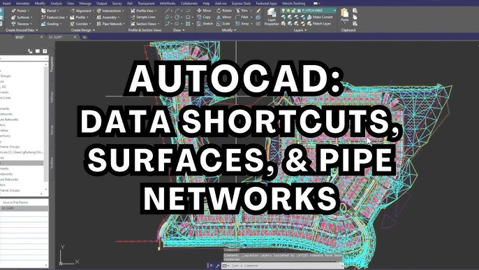
Understanding Surfaces in AutoCAD Civil 3D:
In AutoCAD Civil 3D, a surface represents the topographic or terrain features of a site, depicted as a three-dimensional model composed of interconnected triangles or grid elements. Surfaces are essential for analyzing grading, drainage, and earthwork quantities, providing engineers and designers with critical insights into the project’s feasibility and constructability.
Creating Surfaces:
The process of creating surfaces in AutoCAD Civil 3D involves several steps, each tailored to capture and represent the terrain characteristics accurately:
1. Importing Survey Data:
Begin by importing survey data, including points, breaklines, and contours, obtained from field surveys or existing topographic maps. AutoCAD Civil 3D offers various methods for importing and processing survey data, ensuring compatibility and accuracy throughout the design process.
2. Point Group Classification:
Organize imported survey points into logical groups based on their characteristics, such as existing ground points, breakline vertices, or feature points. Point groups facilitate efficient data management and allow for selective display and analysis of specific point subsets.
3. Creating Surface Definition:
Once the survey data is imported and classified, create a surface definition within AutoCAD Civil 3D. This involves specifying the boundary, or extent, of the surface and selecting the appropriate data components, such as points, breaklines, and contours, to be included in the surface model.
4. Surface Generation:
With the surface definition established, generate the surface model using AutoCAD Civil 3D’s surface creation tools. The software employs sophisticated algorithms to interpolate elevation values between data points and construct a continuous, triangulated surface representation of the terrain.
5. Surface Analysis and Refinement:
After generating the initial surface model, perform thorough analysis and refinement to ensure accuracy and completeness. This may involve inspecting surface contours, identifying and correcting anomalies or discrepancies, and validating the surface against field measurements or reference data.
Advanced Surface Modeling Techniques:
In addition to the basic surface creation process, AutoCAD Civil 3D offers advanced techniques and tools for refining and enhancing surface models:
1. Feature Lines and Grading:
Utilize feature lines to define complex grading patterns, such as berms, swales, and retaining walls, within the surface model. Feature lines provide precise control over surface geometry and facilitate the creation of graded areas with varying slopes and contours.
2. Surface Editing and Analysis:
Employ AutoCAD Civil 3D’s editing tools to modify surface geometry, such as adding or removing breaklines, adjusting elevation values, or smoothing irregularities. Perform comprehensive surface analysis, including slope analysis, cut and fill calculations, and watershed delineation, to evaluate design alternatives and optimize surface performance.
3. Surface Interpolation and Extrapolation:
Explore advanced interpolation and extrapolation techniques to extend surface boundaries beyond the original survey data or interpolate elevation values in areas with sparse or incomplete data coverage. AutoCAD Civil 3D offers interpolation methods, such as natural neighbor, grid, and spline interpolation, to accurately model surface features and transitions.
4. Surface Visualization and Presentation:
Leverage AutoCAD Civil 3D’s visualization tools to create compelling visualizations and presentations of surface models. Apply materials, textures, and shading effects to enhance surface visibility and communicate design intent effectively to stakeholders and project collaborators.
Best Practices for Surface Modeling:
To achieve optimal results when creating surfaces in AutoCAD Civil 3D, it’s essential to adhere to the following best practices:
1. Data Quality Assurance:
Ensure the accuracy and integrity of survey data by conducting thorough quality assurance checks and validation procedures. Verify data consistency, resolution, and spatial accuracy to minimize errors and discrepancies in the surface model.
2. Model Organization and Naming Conventions:
Adopt a systematic approach to organizing surface models, including consistent naming conventions, layering schemes, and annotation standards. Establish clear workflows for version control, collaboration, and data exchange to streamline project management and communication.
3. Iterative Design and Evaluation:
Embrace an iterative design process that allows for continuous refinement and optimization of surface models based on feedback and analysis results. Iterate through design alternatives, evaluate performance criteria, and incorporate feedback from stakeholders to iteratively improve the surface model.
4. Collaboration and Coordination:
Foster collaboration and coordination among project team members, including engineers, surveyors, and designers, to ensure alignment and consistency across design disciplines. Facilitate open communication, document sharing, and coordination meetings to address conflicts, resolve issues, and maintain project momentum.
5. Continuous Learning and Skill Development:
Invest in ongoing training and skill development to stay abreast of the latest advancements and best practices in surface modeling and AutoCAD Civil 3D software. Participate in training courses, workshops, and professional development opportunities to enhance proficiency and expertise in surface modeling techniques.
Conclusion:
In conclusion, creating surfaces in AutoCAD Civil 3D represents a critical aspect of civil engineering design and analysis, enabling engineers and designers to accurately represent terrain features and inform decision-making processes. By understanding the fundamental principles of surface modeling, leveraging advanced techniques and tools, and adhering to best practices, professionals can create surface models that meet the highest standards of accuracy, reliability, and functionality. With AutoCAD Civil 3D as a powerful ally, engineers and designers can confidently tackle complex design challenges and deliver innovative solutions that shape the built environment for generations to come.