Mastering 3D Modeling and Visualization in Civil 3D: A Comprehensive Guide
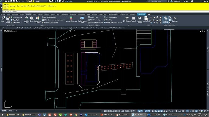
AutoCAD Civil 3D, a flagship software developed by Autodesk, is renowned for its advanced capabilities in civil engineering design and documentation. Among its myriad features, the ability to create, manipulate, and display 3D models stands as a cornerstone for engineers and designers working on complex infrastructure projects. In this comprehensive guide, we delve deep into the intricacies of drawing and displaying 3D models in Civil 3D, exploring fundamental concepts, workflow strategies, and advanced techniques to unlock the full potential of 3D design visualization.
Understanding 3D Modeling in Civil 3D:
In Civil 3D, 3D modeling refers to the creation of three-dimensional representations of civil engineering elements, such as terrain surfaces, road alignments, profiles, and structures. These 3D models serve as the digital prototypes of real-world infrastructure projects, enabling engineers and designers to visualize, analyze, and optimize design concepts before construction begins.
Drawing 3D Models:
The process of drawing 3D models in Civil 3D involves several key steps, each tailored to capture and represent the spatial characteristics of the project:
1. Creating 3D Objects:
Begin by creating 3D objects, such as surfaces, alignments, profiles, and corridors, using Civil 3D’s specialized design tools. These objects serve as the building blocks for the 3D model and provide the basis for further analysis and visualization.
2. Defining Coordinate Systems:
Establish the coordinate systems and reference planes necessary for accurate spatial positioning and orientation of 3D elements within the model. Civil 3D offers various coordinate system options, including global coordinates, local coordinates, and project-specific coordinate systems, to accommodate diverse project requirements.
3. Incorporating Survey Data:
Integrate survey data, such as points, breaklines, and contours, into the 3D model to ensure alignment with existing topographic features and terrain conditions. Civil 3D provides tools for importing, processing, and georeferencing survey data, enabling engineers to create accurate representations of the project site.
4. Modeling Infrastructure Elements:
Model infrastructure elements, such as roads, intersections, bridges, and drainage systems, within the 3D environment using Civil 3D’s design tools and feature sets. Incorporate design criteria, standards, and regulations to ensure compliance and functionality of the infrastructure elements within the model.
Displaying 3D Models:
Once the 3D model is created, displaying it effectively is essential for communicating design intent and facilitating decision-making processes. Civil 3D offers a range of visualization tools and techniques to enhance the presentation and interpretation of 3D models:
1. Viewing Options:
Utilize Civil 3D’s versatile viewing options to manipulate the perspective, orientation, and visibility of the 3D model. Explore different view styles, such as wireframe, shaded, and realistic, to achieve the desired level of detail and clarity in the visualization.
2. Lighting and Rendering:
Apply lighting and rendering effects to the 3D model to enhance visual realism and depth perception. Adjust lighting parameters, such as intensity, direction, and color, to simulate natural lighting conditions and highlight key design features within the model.
3. Section and Profile Views:
Generate section and profile views of the 3D model to analyze cross-sectional and longitudinal characteristics of the infrastructure elements. Civil 3D’s section and profile tools allow engineers to extract and visualize critical design information, such as elevations, grades, and slopes, along specified alignment or corridor paths.
4. Annotation and Labeling:
Annotate the 3D model with dimensions, labels, and callouts to provide context and clarity to design elements and features. Civil 3D’s annotation tools enable engineers to add text, symbols, and graphical elements directly to the 3D model, facilitating communication and documentation throughout the design process.
Advanced Visualization Techniques:
In addition to basic visualization capabilities, Civil 3D offers advanced techniques and tools for creating immersive and interactive 3D presentations:
1. Flythrough and Walkthrough Animations:
Generate flythrough and walkthrough animations of the 3D model to simulate virtual tours of the project site. Civil 3D’s animation tools allow engineers to create dynamic, cinematic presentations that showcase design concepts and spatial relationships from various perspectives.
2. Virtual Reality (VR) Integration:
Integrate Civil 3D models with virtual reality (VR) platforms to experience immersive, real-time visualization of infrastructure projects. By leveraging VR technology, engineers can explore design alternatives, evaluate spatial relationships, and identify potential issues in a collaborative and interactive virtual environment.
3. Clash Detection and Analysis:
Conduct clash detection and analysis within the 3D model to identify and resolve spatial conflicts and interferences between design elements. Civil 3D’s clash detection tools enable engineers to detect clashes between infrastructure components, such as utilities, structures, and road alignments, and facilitate coordination and resolution of design conflicts.
4. Visualization Standards and Templates:
Develop visualization standards and templates for consistent presentation and documentation of 3D models across projects. Establish guidelines for visual styles, annotation conventions, and presentation layouts to ensure clarity, consistency, and professionalism in the visualization of civil engineering designs.
Best Practices for 3D Modeling and Visualization:
To achieve optimal results when drawing and displaying 3D models in Civil 3D, it’s essential to adhere to the following best practices:
1. Plan and Organize:
Develop a comprehensive plan for creating and visualizing 3D models, including project objectives, scope, and deliverables. Organize project data, files, and resources in a structured manner to facilitate efficient collaboration and data management throughout the design process.
2. Standardize Workflows:
Establish standardized workflows and procedures for 3D modeling and visualization tasks to ensure consistency and repeatability across projects. Document best practices, guidelines, and procedures in a project-specific manual or knowledge base to facilitate knowledge sharing and training for team members.
3. Embrace Iterative Design:
Embrace an iterative design process that encourages exploration, experimentation, and iteration of design alternatives within the 3D model. Solicit feedback from stakeholders, conduct design reviews, and incorporate user input to refine and improve the design solution iteratively.
4. Optimize Performance:
Optimize the performance of Civil 3D and the 3D model by managing file size, complexity, and system resources effectively. Implement strategies for file organization, layer management, and data optimization to minimize processing times and enhance productivity during 3D modeling and visualization tasks.
5. Continuous Learning and Skill Development:
Invest in ongoing learning and skill development to stay abreast of the latest advancements and best practices in 3D modeling and visualization techniques. Participate in training courses, workshops, and professional development opportunities to enhance proficiency and expertise in Civil 3D software and 3D visualization tools.
Conclusion:
In conclusion, mastering the art of drawing and displaying 3D models in Civil 3D represents a critical skill for civil engineers and designers working on infrastructure projects. By understanding the fundamental principles of 3D modeling, leveraging advanced visualization techniques, and adhering to best practices, professionals can create immersive, informative, and impactful visualizations that communicate design intent effectively to stakeholders and decision-makers. With Civil 3D as a powerful tool, engineers and designers can visualize, analyze, and optimize complex infrastructure projects with confidence and precision, ultimately contributing to the advancement of the built environment and the improvement of society’s quality of life.
